28 Sep Finished Bikepacking The Baldy Bruiser


One of the first things that happened when I got back from my Northern Tier tour in 2019 was when my brother-in-law, Sang, told me he wanted to finish bikepacking the Baldy Bruiser ride that we started back in June 2018.
He had organized the ride with everyone who went in 2018, but because of scheduling conflicts, we ended up being the only two who were able to do it on October 22, 2019.
To be honest, there was some hesitation going into this ride given the fact of how bad it was for us the first time around. On top of that, we were not allowed to use any fire to cook or start a campfire. There was a state-wide ban on using fire in the forest. So there was that challenging ordeal.
But, I figured I’d be at my healthiest I’ve been for the year after my Northern Tier tour, and it would be a great way to stay conditioned for Puerto Rico in December.
Day 1
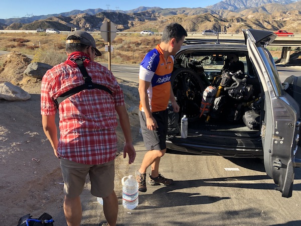
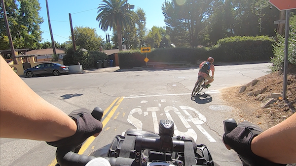
The ride quickly went underway as soon as we unloaded our bikes from the car. My sister graciously bid us farewell as she retraced her route on I-15 to head home, while we continued where we left off in Cajon Pass.
We immediately got on some dirt road and rode through a swarm of bees (I know, what a crazy way to start this trip). Luckily, nobody got stung and we continued on our way over to highway 138.
Instead of going west, we went east on a detour to the nearest gas station close to the highway to stock up on some electrolyte drinks, snacks and lip balm.
Once everything was acquired, we retraced our path on highway 138 and made a left turn to go up Lone Pine Canyon Road. This road was a 2 lane road on which cars were driving up and down frequently.
Our hearts were pumping when we reached a turn-off onto Swarthout Canyon Road. This fireroad took us into a remote trail that crossed the Pacific Crest Trail and we turned right onto Sheep Creek Truck Trail.
Sheep Creek Truck Trail took us up some steep climbs and rewarded us with a beautiful view of the Cajon Junction before we opted to take Sheep Canyon Road down into Lytle Creek.
Made it into town
We popped into the Applewhite Picnic Area only to see that they were closed. The downhill then led us past the Applewhite Campground, but since it was only noon or so, we decided that we had time to explore Lytle Creek for a bit.
We rolled down into town and found a little restaurant called Melody’s Place (551 Lytle Creek Rd, Lytle Creek, CA 92358). Not only was it a restaurant, they also had a convenience store and some gift shops with Autumn and Christmas decorations and gifts.
Sang and I sat down to order some sandwiches, fries and a soda for lunch. The meal was much needed as we got back on our bikes and slowly crept up the hill that we flew down an hour ago.
At Applewhite Campground, we self-checked in and found a spot with some flat grounds and set up camp for the night.
There were a few people around, but there was a camper across the way that kept playing loud music into the night and set off his alarm. Needless to say, we didn’t have a restful sleep.
There were very persistent bugs that kept on buzzing around our ears the entire time. Luckily, as the sun set and the temperature dipped, they all disappeared.
Day 2
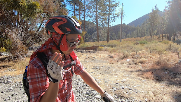
We woke up around 7:00 to quickly tear down camp and have our breakfast before we left the campground.
We made a right on the same road we came down on from the previous day, Lytle Creek Road, and pretty much was on an upward trajectory.
Eventually, the paved road gave way to a rocky and unpaved terrain. There were some sections where the dirt road was smooth, but the majority of the way had us dodging rocks and forcing us to dismount our bikes and walk.
We connected with the Forest Road 3N06A which was a series of switchbacks up to Mount Baldy Resort area. We took Mt. Baldy Road down into the trailhead to Mt. Baldy.
Look Mom, no brakes!
On the descent, I was losing the ability to stop as my front brakes were wearing thin. I had to gingerly make my way down on the dirt road as Sang helped to keep a watchful eye.
We eventually made it onto the paved road that was Mt. Baldy Road. We pulled over to check out Manker Campground with the initial intention of staying there, but the problem was that we needed to resupply for dinner and breakfast and there were no services near the campground.
We would need to ride down into town and hope to find a store that was open, buy the supplies and then ride up to the campground. With this in mind and how tired we were from the ride, Sang offered to pay for an indoor stay.
Mt. Baldy Lodge
I wasn’t going to stop him so we both abandoned the camping option and made our way into the center of Mt. Baldy where we stopped at Mt. Baldy Lodge for lunch.
After lunch, we searched for a motel to stay in and found one that appeared to be open. However upon asking the front desk, we were informed that they had closed it the day before. With our options being limited, Sang decided that we go back to Mt. Baldy Lodge and rent out a cabin.
It cost him a pretty penny, but he was willing to shell that out for a comfortable stay indoors. We took our showers to wash away the dirt that had accumulated from 2 days of riding gravel.
The cabin had a metal roof so throughout the night, acorns falling from the trees outside kept pelting and making banging sounds. At first it was alarming, but we quickly ignored it as we succumbed to our tired bodies.
Day 3
The next morning, we woke up to howling winds that were blowing across our cabin’s windows. We both quickly looked at the forecast and saw that it was going to be a windy day in Southern California.
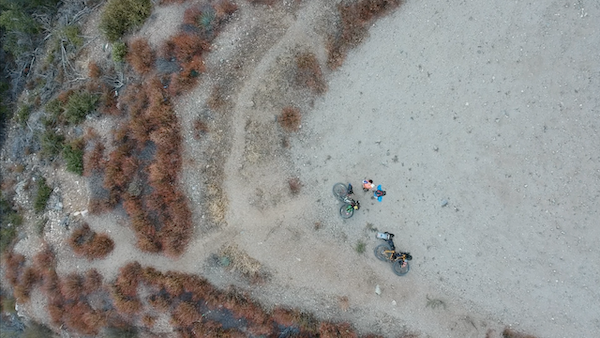
It wasn’t so bad when we left Mt. Baldy Lodge and found Glendora Ridge Road. It wasn’t bad until we reached the top of the ridge where the wind started to pick up. It was blowing pretty hard as we pedaled effortlessly down hill.
We pulled over to enjoy the view of the canyon and mountains. Even had a chance to fly the drone over this area.
Glendora Ridge Road eventually came to a halt at the gate where we carried our bikes around and turned onto Glendora Mountain Road. We rode down to the end of the road and got on East Fork Road where we stopped at the restaurant in front of Camp Williams Resort, a RV park.
Sang thought that there may have been camping options there, but upon investigating, we decided to just finish our packed lunch and continue on our way. Plus, it was still early in the day.
We ran into some road cyclists there and met a gentleman named “DT”. He was very curious about bikepacking and biketouring, so we gave him links to Milestone Rides. DT has since joined us on 2 rides (prior to the pandemic).
Coming upon some familiar territory, we rode out onto Highway 39. This was the road we took for our Cogswell trip in 2015. Instead of turning into the Cogswell Dam area, we took the Rincon Shortcut OHV Trail.
Water concerns
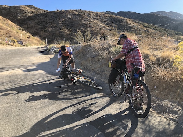
This was a tough uphill as we battled the heat and hunger. We underestimated how difficult this section was going to be and by the time the sun had set, both Sang and I had only 16 ounces of water left. This was barely enough for dinner and overnight use.
We were at a really desolate campground called Spring Campground. To get to camp, you had to go down a steep narrow road with overgrown plants. Then ride across some more overgrown grass and plants until you see this pristine pit toilet.
You then cross over a bridge and find yourself with 3-4 open campsites. We couldn’t find a reasonable place to refill our water and there was a campfire ban at the time, so we couldn’t start a campfire.
Instead, we ate a cold dinner and went to bed early as we were engulfed by 2 mountains and their shadow.
Day 4
We woke up at 4:30 AM and packed up our gear and walked our bikes up to the fire road we were on the previous day and started our descent down towards East Fork Campground.
We were so glad to see a creek filled with water. Both Sang and I spent 30 minutes filtering and refilling all our bottles and hydration bags. This campground would have been a better stay if it wasn’t because of my brake issues and it being so dark.
The rest of the ride towards Red Box near Mount Wilson started out great as we were relieved to have found water, but grew tough as the route had us going on some narrow single tracks. At the end of the route near Red Box, we had to lift our bikes up a long flight of stairs. That was tough to do after being exhausted from the ride.
We rested at Red Box and refilled our water once again. Our rations have dwindled to a handful of snacks.
All downhill from here
Instead of worrying about it, we decided that we just had to get to Mount Lowe Road and start riding down towards Altadena. That was our best bet at getting refueled.
I quickly led the way and was waiting for Sang at the trailhead for a good 30-45 minutes. I had a gentleman there who kept me company telling me stories of his grandson’s athletic prowess. He was there looking for deer to hunt.
The rest of the ride down through Mount Lowe Road was fun, but scary for me as I couldn’t stop at all towards the end of the ride. I had to fly pass a stop sign at the bottom of the hill and was nervously figuring out how to bail if the bike didn’t stop.
Luckily, we were out of steep hills to ride, so I comfortably glided down into a strip mall on Lincoln and Woodbury where we bought lunch and waited for my sister to pick us up.
Mission accomplished
What should have taken us about 4 days to do, took us about 10 days starting in 2018 and finally wrapping up in 2019. We agree that the best way to approach the Baldy Bruiser (if we were to do it again) is to find a ride up to Big Bear first instead of riding from the San Bernardino Metrolink station.
That trip up cost us about 2-3 days. If we were to bypass that part, we would have completed the Baldy Bruiser in about a week.
When we had to abandon the route in 2018, I knew there was no way I was going to not complete it. I was also nervous given how challenging it was back then, but was relieved to see that even as challenging as it got on this trip, it was nothing compared to the first part.
We are glad that we didn’t have to scale walls of boulders or slippery 30% sandy grade. Yes, we dealt with water and food shortage, but this certainly helps us to plan better for the next ride that we do.
If you’re thinking about doing the Baldy Bruiser, learn from our mistakes and take the proper precautions. It’ll make things a lot easier on yourself.
I know a few have indicated that the ride up to Mount Baldy Resort from Lytle Creek is the worst of it, but I don’t agree with that assessment. The worst was riding from Big Bear to Lake Arrowhead. Of course, that’s going westbound.
Let me know what you thought about the video and this write up. Let me know if you’ve done the route yourself.
Resources
For your convenience, here are some links that will help with your planning.
- Baldy Bruiser (Bikepacking.com)
- Camping Spots We Used
- Applewhite Campground – 487 N Lytle Creek Canyon Road, Lytle Creek, CA 92358, (909) 382-2851, https://www.fs.usda.gov/recarea/sbnf/recarea/?recid=26529
- Mt Baldy Lodge – 6777 Mt Baldy Rd, Mt Baldy, CA 91759, (909) 982-1115, http://www.mtbaldylodge.com/
- Spring Camp Campground – Upper Clamshell Truck Trail, Monrovia, CA 91016, (626) 574-1613, https://www.fs.usda.gov/recarea/angeles/recarea/?recid=41700
- Restaurants
- Melody’s Place – 551 Lytle Creek Rd, Lytle Creek, CA 92358, (909) 880-0606
- Camp Williams Resort – 24210 E Fork Rd, Azusa, CA 91702, (626) 910-1126, http://campwilliams.com/
- Panda Express – 2234 Lincoln Ave, Altadena, CA 91001, (626) 794-0386, https://www.pandaexpress.com/
- My Strava Activities
- Cajon Junction to Lytle Creek – https://www.strava.com/activities/2816570877
- Lytle Creek to Mt Baldy – https://www.strava.com/activities/2816571069
- Mt Baldy to Spring Camp – https://www.strava.com/activities/2816571352
- Spring Camp to Altadena – https://www.strava.com/activities/2816724224
- Read about Baldy Bruiser Part 1.
Sorry, the comment form is closed at this time.